
2.5 Acres With Power, Ideal Hobby Farm Land In Paulden, Yavapai County AZ
2300 Santa Fe Rd, Paulden, AZ | Lat/Lng: 34.8966, -112.5105
$39,999
2.5 ac.
05/05/2026
ACTIVE

Description
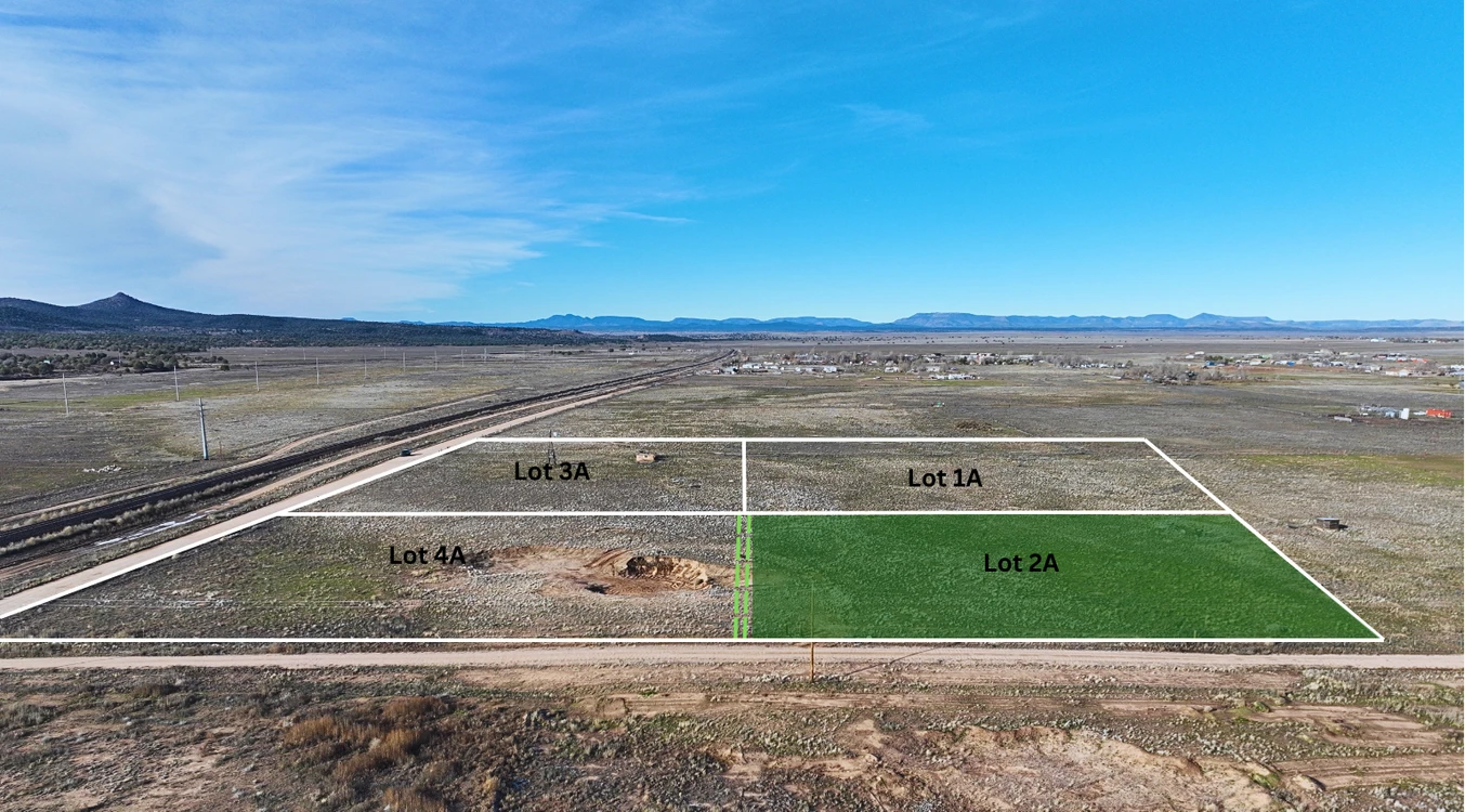
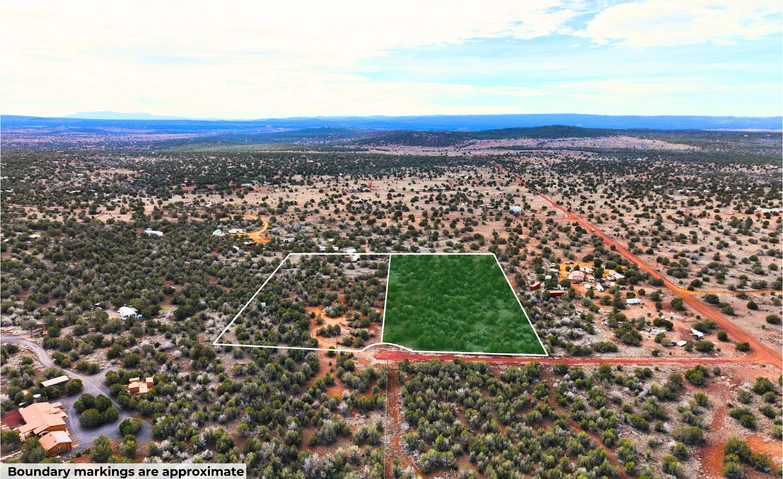
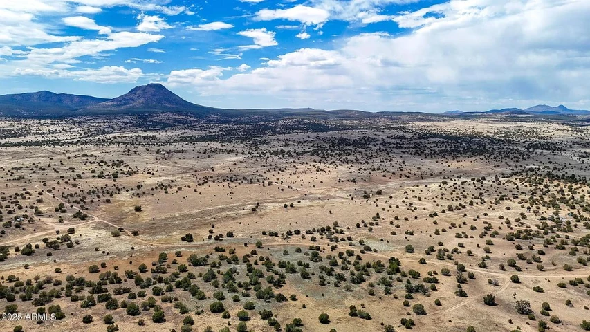
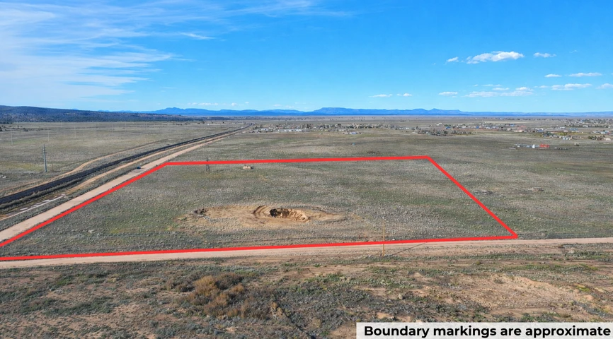
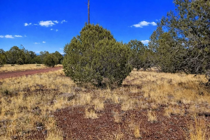
This 2.5-acre parcel in Paulden offers level terrain with power already running along Troy Ln. You can camp in an RV for up to 10 days, three times per year, use it for a hobby farm with livestock or horses, or build a new site-built home.
The RCU-2A zoning gives you flexibility for residential use on this flat parcel. At 4,383 feet elevation, you wont swelter in the summer. If building, youll need to drill a well for water and install a septic system for sewage. The property sits in a floodway zone, so check flood requirements for any permanent structures you plan to build.
Road access connects directly to your property line. The level ground and existing power connection mean you can start using this land right away for camping while you plan your next steps. You have plenty of room to spread out and build while staying within the required setbacks.
Or Choose Your Owner Financing Plan Starting From $3,999 Down
Do you want your own custom plan? call or text us today to discuss how much you'd like to put down.
There are NO Credit Checks. There is NO Prepayment Penalty, you can pay off the property at any time. Title is Free and Clear.
You can easily secure this property today to start enjoying everything that Arizona has to offer. Call or Text us anytime to get started or learn more.
Details
Address: 2300 W Santa Fe Rd, Paulden, 86334
Parcel Number: 304-02-031B
Legal Description: A portion of the South Half of the East half of the Southwest Quarter of the Southeast Quarter of Section 31, Township 18 North, Range 2 West of the Gila and Salt River Base and Meridian, Yavapai County, Arizona
County: Yavapai
Size: 2.5 Acres
Property Survey or Plat Map: Yes click here to view plat map
Power: Yes, along Troy Ln
Water: Would be well
Sewage: Would be septic
Phone: Cell or Satellite (coverage map)
Zoning: RCU-2A Rural Residential (Yavapai County Zoning Ordinance)
Camping and RV: RVs are allowed for up to 10 days at a time, up to three times per year. RV is allowed while building with a temporary dwelling permit (Yavapai County Land Use Code)
Mobile Homes Allowed: No
Manufactured Homes Allowed: No
Site Built Homes Allowed: Yes
Minimum Square Footage: No specific requirement
HOA: N/A
Flood Zone: Yes (Refer to Land id map above)
Wetlands: No (Refer to Land id map above)
Access: Dirt road
Annual Property Taxes: $140
General Elevation: 4,383 feet
Terrain: Level
Dimensions (approximate): 331 x 319 x 329 x 318 feet
Conveyance: Warranty Deed
Title: Free and Clear
Google GPS Corner Coordinates (approximate)
NW: 34.8971, -112.5111
NE: 34.8971, -112.5101
SW: 34.8962, -112.5111
SE: 34.8962, -112.5101
Approximate Distance to Nearby Cities & Points of Interest
8 minutes to AZ 89
8 minutes to Paulden: Population 5,567
19 minutes to Chino Valley: Population 13,100
45 minutes to Prescott: Population 46,300
1 hour 21 minutes to Flagstaff: Population 78,000
2 hours 11 minutes to Phoenix: Population 1,730,000
2 hours 10 minutes to Phoenix Sky Harbor International Airport
Points Of Interest
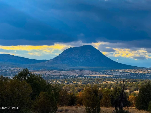
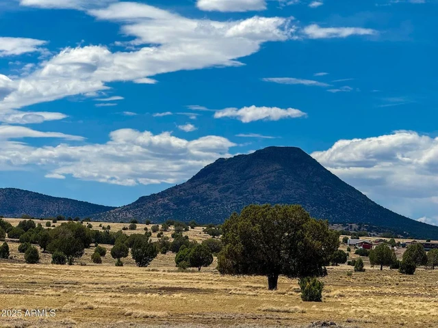
Escape to the breathtaking beauty of Prescott National Forest in Arizona, where nature unfolds its wonders in every direction. Explore dense pine forests, crystal-clear lakes, and hiking trails that beckon adventure. Whether youre a seasoned outdoors enthusiast or just looking for a peaceful retreat, Prescott National Forest invites you to discover the charm of Arizonas wilderness with open arms and a warm welcome.
21 minutes to Prescott National Forest
Activities at Prescott National Forest: camping, fishing, boating and kayaking, hiking, walking, mountain and road biking.
1 hour 28 minutes to Coconino National Forest
Activities at Coconino National Forest: hiking, fishing, walking, mountain and road biking, overlanding, off-roading.
Are you a hunter or fisherman? Property is bordering Game Management Unit 19A and 19B in Region 3 Kingman.
Nearby game includes: elk, deer, black bear, antelope, quail, mountain lion.
Nearby fish includes: bass, catfish, crappie, trout.
Lots of nearby walking, hiking, and biking trails to choose from: FR 21 OHV Route, Granite Basin MTB Loop, Prescott Circle Trail, United Verde OHV Trail, Glassford Summit Trail, Yeager Canyon Loop Trail.
Are you a hunter or fisherman? Property is bordering Game Management Unit 19A and 19B in Region 3 Kingman.
Nearby game includes: elk, deer, black bear, antelope, quail, mountain lion
Nearby fish include: bass, catfish, crappie, trout
Lots of nearby walking, hiking, and biking trails to choose from: FR 21 OHV Route, Granite Basin MTB Loop, Prescott Circle Trail, United Verde OHV Trail, Glassford Summit Trail, Yeager Canyon Loop Trail.
Details
County: Yavapai
Zipcode: 86334
Property Type One: Residential Property
Property Type Two: Undeveloped Land
Brokerage: Compass Land USA
Brokerage Link: www.compasslandusa.com/property

Andrew Gaasenbeek
Compass Land USA
(313) 349-0434
By clicking the button, you agree to our Terms of Use and Privacy Policy.


Nearby Listings
Yavapai County, AZ

$49,995 - 2 ac.
Coconino County, AZ
$38,999 - 5 ac.
Yavapai County, AZ
$19,500 - 10 ac.
Yavapai County, AZ
$19,500 - 10 ac.
Yavapai County, AZ
$19,500 - 10 ac.
Yavapai County, AZ
$99,999 - 10 ac.
Coconino County, AZ

$5,000,000 - 100 ac.
Coconino County, AZ

$39,000 - 4 ac.
Coconino County, AZ
$13,500 - 2 ac.
Yavapai County, AZ

$23,000 - 10 ac.