
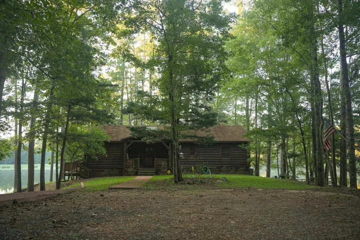
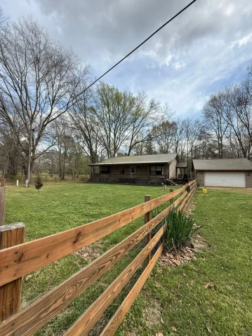
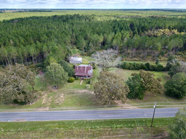
Williams Creek Tract
1200 State Highway 472, Pinola, MS | Lat/Lng: 31.8494, -90.0126
$536,125
190.1 ac.
01/03/2025
ACTIVE


Description
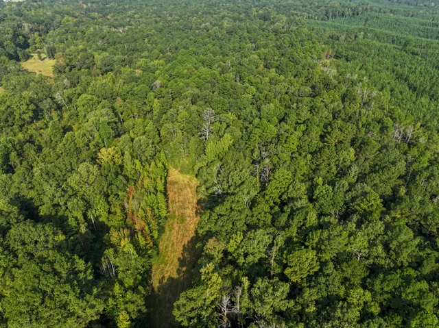
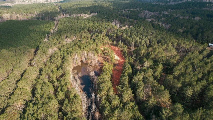
Step into a premium investment and recreational opportunity with this 190.1-acre tract of meticulously managed timberland. Nestled near the solitude of Pinola, MS, this property features:
Diverse Timber Stands: Pine (628 years old) and Hardwood (4458+ years old) covering 183.8 acres, providing both pulpwood and Chip-N-Saw sized stands of varying densities.
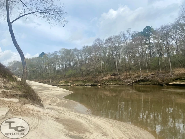
Creek Frontage: Over 5,043 feet along Williams Creek, ideal for enhancing wildlife and aesthetic value.
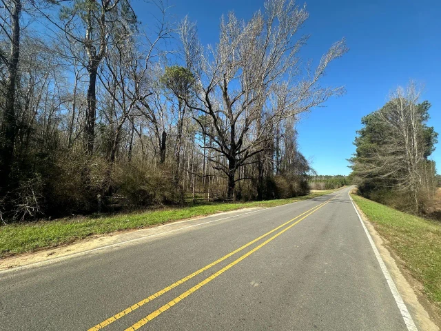
Infrastructure: 5,250 feet of interior roads and seamless access via a permanent easement from Highway 478.
Utility Access: Electric power located just 750 feet away.
Rolling Topography: 100% Usable land without FEMA flood zones.
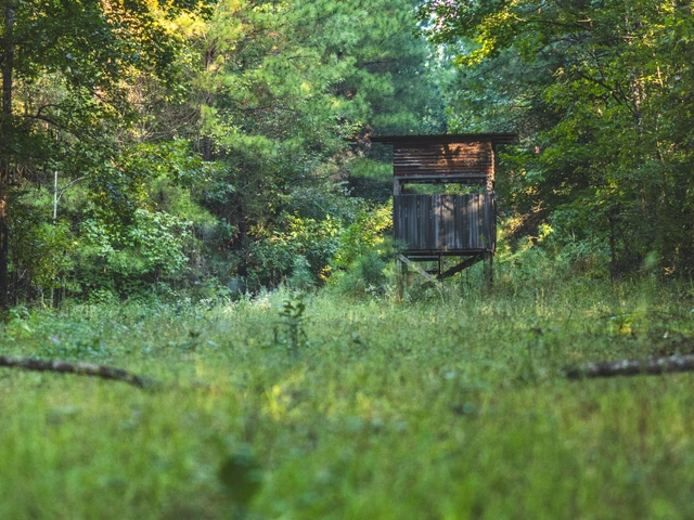
With five open areas ready for conversion to wildlife food plots, this property is perfect for sportsmen, conservationists, or investors looking for exceptional land management and recreational potential. Currently unoccupied by hunters, it offers pristine peace and quiet rarely found in todays market.
This is more than timberlandits a legacy. Contact us to explore this one-of-a-kind opportunity.
Just the Facts:
Sales Price: $536,125 or $2,820.23/ac
Tract Acreage: GPS Mapped 190.1; Deeded 190.0; Taxed 190.0
Tract Location-
Legal: NW4 NE4; NE4 NE4 less NE4; SE4 NE4; E2 SE4 . Section 9, T10N, R20W, Simpson County, MS
Address: McIntosh Dr, Pinola, MS 39149
Lat: 3151 36.5 N
Long: 9001 07.2 W
Paved Road Frontage: None, Access via easement.
Interior Roads: 5,250
Utilities-
Water: Boggan Ridge Rural Water As.
Electric: So. Pine EPA
Topography: Rolling
Zoning: Rural, Timberland
Ad Valorem Taxes: 2024 $571.15
FEMA Flood Zone: No Portions lie within the 100 year flood zone. MAP # 28127C0300D
History: Timberland
Mineral Rights: None
Streams: Williams Creek-5,043
Soils: Name, % Area, Loblolly Site Index
Petal & Smithdale 8-15% slope, 55.2%, 88
Petal & Smithdale 15-35% slope, 31.4%, 88
Savannah Loam 2-5% slope, 25.5%, 81
Estimated Driving Times to Tract:
New Orleans: 175 mi, 2hr 46 min
Baton Rouge: 169 mi, 2hr 38 min
Jackson: 45 mi, 54 min
Hattiesburg: 66 mi, 1hr 12min
Species Available for Hunting:
White-tailed Deer Wild Turkey
Squirrel Rabbit
Medium of Exchange: Cash or Equivalent/occupancy on closing.
Owner Financing Available? No
Sub-dividable?: No, tract offered in its entirety.
How to view the property: You can schedule a site visit by contacting me at (O) 601.587.4446 or (M) 601.594.1564 to set up a time, OR if you would like to visit the site on your own we request that you fill out a Temporary Access Permit
Timber: Stand#-Type-Acres-Age
100 -(PI3)Pine Intermediate High Density-6.0 ac.-28 yrs
101 -(PI2)Pine Intermediate Med. Density-118.3 ac.-28 yrs
102 -(PP2)Pine Pulpwood Med. Density-30.3 ac.-20 yrs
103 -(PP4)Pine Pulpwood Very High Density-1.2 ac.-20 yrs
104 -(PP3)Pine Pulpwood High Density-6.5 ac.-20 yrs
105 -(HI2)Hardwood Intermediate Med. Density-17.6 ac.-58+yrs
106 -(HP2)Hardwood Pulpwood Med. Density-10.2 ac.-44yrs
No recent timber cruise available.
Details
County: Simpson
Zipcode: 39149
Property Type One: Recreational Property
Property Type Two: Timberland
Property Type Three: Hunting Land
Brokerage: Timberland Sales, LLC
Brokerage Link: www.timberlandsales.com
Apn: 12120090000000000200

Mark Dale
Timberland Sales, LLC
(601) 587-4446
By clicking the button, you agree to our Terms of Use and Privacy Policy.


Nearby Listings
Rankin County, MS
$3,850,000 - 736 ac.
Copiah County, MS
$500,250 - 145 ac.
Rankin County, MS
$5,133,254 - 1194 ac.
Rankin County, MS
$59,995 - 5 ac.
Copiah County, MS
$199,000 - 20 ac.
Lawrence County, MS
$385,000 - 68 ac.
Smith County, MS

$260,000 - 112 ac.
Hinds County, MS

$415,000 - 54 ac.
Lawrence County, MS
$150,000 - 43 ac.
Lincoln County, MS
$1,039,500 - 231 ac.