
Rimcrest on St Charles River
TBD S. Waterbarrel Road, Pueblo, CO | Lat/Lng: 38.0693, -104.8465
$595,000
200 ac.
11/13/2025
ACTIVE
Description
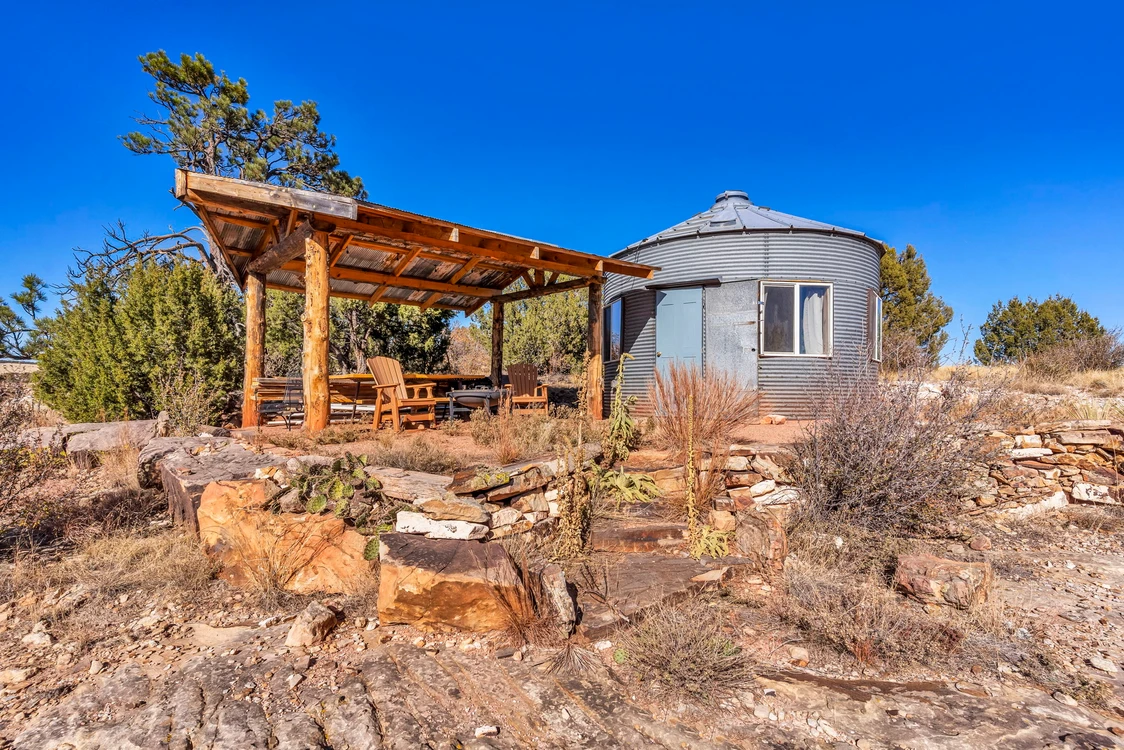
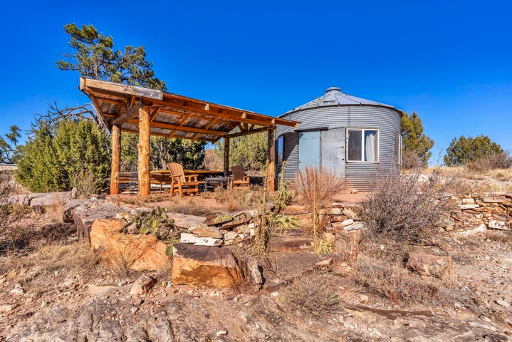
193 ACRES ON 1 MILE OF ST. CHARLES RIVER RIM-TOP GRAIN SILO GLAMPING WITH EPIC CANYON VIEWS!
Pueblo, CO | 193 Deeded Acres | Loft Silo | Furnished | Off-Grid Solar
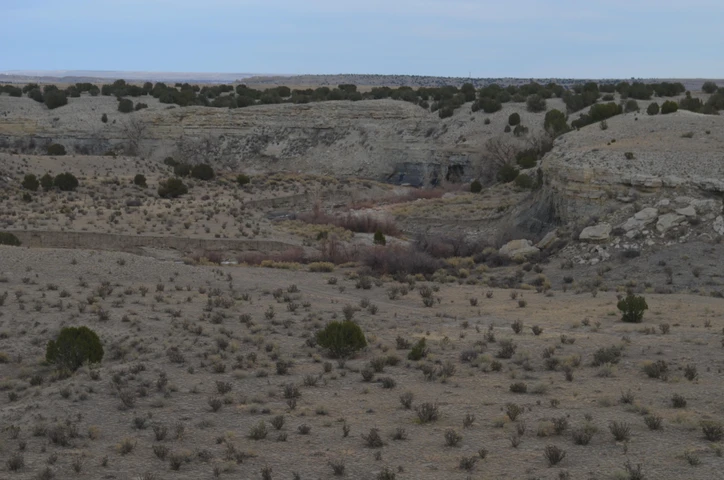
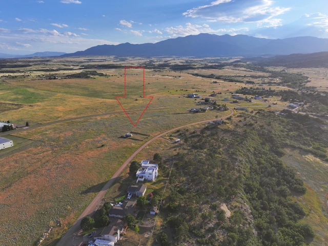
Perched on the dramatic rim of a 100-ft canyon, this 193-acre riverfront ranch offers one full mile of both sides of the St. Charles River winding through a lush, grassed valley below. A charming converted grain silo has been glamped-up into a rustic livable space.
Land
193 contiguous deeded acres
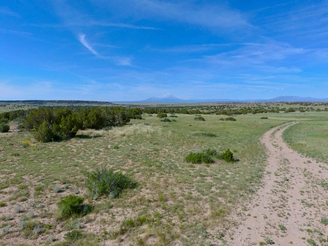
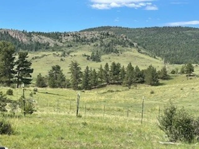
1 mile of private St. Charles River frontage (both banks) with pinon, juniper, willows, and grassy meadows
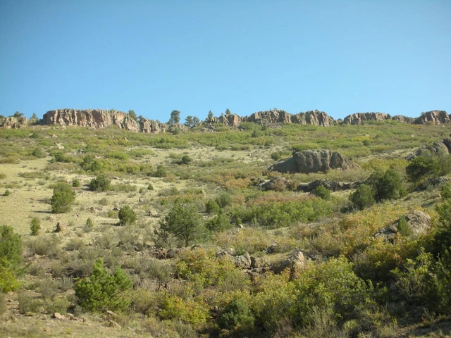
100 ft of elevation change: rim-top plateau (5,500 ft) down to fertile river bottom (5,400 ft)
Diverse terrain: pion-juniper ridges, hidden draws, and south-facing slopes
No HOA | No conservation easement |
Improvements
Glamped-up Grain silo Charming and rustic grain silo converted to glamped-up space with indoor conveniences from the elements
Fully insulated, wood-finished interior
Partially furnished
20-ft covered front deck with Adirondack chairs and fire pitNice covered front deck perfect to overlook the beautiful canyon below where the St. Charles River meanders through the beautiful grassed river valley
Shaded ramada with picnic table, and BBQ
Gravel driveway and buildable homesites with 360 views
Recreation
Mule deer hunting GMU 84 (Trophy Unit)
Landowner qualifies for Mule Deer, Elk, Pronghorn hunting licenses.(Generally gets one of the three species but this is not guaranteed)
Private river access for fishing or gold panning
Hiking, horseback, and ATV trails from your doorstep to the canyon bottom
Bortle 2 dark skies Experience the amazing dark skies of this beautiful wild country
Agriculture
River bottom meadow nice for a small cattle operation
Private Fishing!
Region & Climate
Location Overview
Rimcrest on The St Charles River is located just Southwest of Pueblo, Colorado, in Pueblo County, on the eastern plains of the state. This semi-arid region is at about 5,200 feet elevation, influenced by the rain shadow of the Rocky Mountains to the west. It features abundant sunshine (over 3,600 hours annually), low humidity, and a large diurnal temperature swing (up to 40F daily). Historical data is based on records from Pueblo Memorial Airport (19912020 normals, with some dating back to 1888).
Climate Classification and General Patterns
Semi-Arid Steppe Climate: Dry overall, with low precipitation (1218 inches/305457 mm annually) and moderate temperatures. About 75% of rain falls AprilSeptember via thunderstorms; winters are dry and cold, with March as the snowiest month and April/May the wettest.
Variability: Elevation creates microclimateslower plains like this area get hotter summers and less snow than nearby foothills. Chinook winds can cause rapid winter warm-ups (up to 70F/21C). The area is on the edge of Tornado Alley, prone to hail, high winds, and occasional floods from intense storms.
Trends: Recent decades show increasing drought frequency, more extreme heat (hot days now outnumber cold ones 3:1), and variable snowfall due to climate change.
Temperature Patterns
Pueblo's climate is continental, with hot summers and cold winters. More than half of summer days exceed 90F (32C). Average annual temperature: ~53.5F (11.9C).
Month
Avg High (F/C)
Avg Low (F/C)
Record High (F/C)
Record Low (F/C)
January
47 / 8
14 / -10
78 / 26 (2020)
-31 / -35 (1951)
February
51 / 11
18 / -8
79 / 26 (2020)
-20 / -29 (various)
March
60 / 16
27 / -3
88 / 31 (2017)
-15 / -26 (various)
April
68 / 20
35 / 2
94 / 34 (various)
10 / -12 (various)
May
78 / 26
45 / 7
100 / 38 (various)
21 / -6 (various)
June
89 / 32
55 / 13
108 / 42 (various)
32 / 0 (various)
July
93 / 34
59 / 15
109 / 43 (2003)
48 / 9 (various)
August
90 / 32
58 / 14
105 / 41 (various)
45 / 7 (various)
September
83 / 28
49 / 9
102 / 39 (various)
26 / -3 (various)
October
71 / 22
37 / 3
95 / 35 (various)
14 / -10 (various)
November
58 / 14
24 / -4
82 / 28 (various)
-5 / -21 (various)
December
48 / 9
15 / -9
71 / 22 (various)
-15 / -26 (2022)
Source: NOAA 19912020 normals; extremes from 18882023 records.
Precipitation and Snowfall Patterns
Annual precipitation averages ~13 inches (330 mm), mostly from convective thunderstorms (JuneAugust peak). Snowfall is light compared to the mountains, averaging ~32 inches (81 cm) per year, concentrated NovemberMarch.
Month
Avg Precipitation (in/mm)
Rainy Days
Avg Snowfall (in/cm)
January
0.3 / 8
3
3.5 / 9
February
0.4 / 10
4
4.0 / 10
March
0.9 / 23
5
4.5 / 11
April
1.5 / 38
6
2.0 / 5
May
1.8 / 46
7
0.5 / 1
June
1.5 / 38
6
0.0 / 0
July
1.9 / 48
7
0.0 / 0
August
1.7 / 43
7
0.0 / 0
September
1.1 / 28
5
0.5 / 1
October
0.7 / 18
4
1.5 / 4
November
0.5 / 13
3
2.5 / 6
December
0.4 / 10
3
3.0 / 8
Annual totals: 13.2 in precip / 335 mm; 32 in snow / 81 cm. July is wettest; January driest.
Location
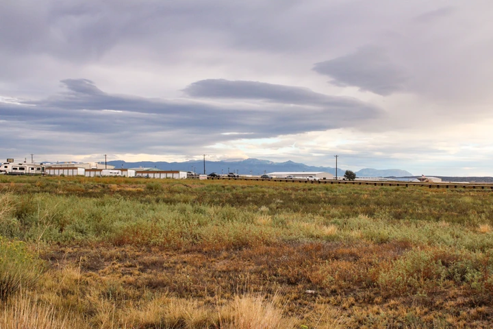
25 minutes to Pueblo (Walmart, hospitals, airport)
25 minutes to Rye (school, caf, post office)
25minutes to Beulah Valley (San Isabel Lake, dining)
Details
County: Pueblo
Zipcode: 81004
Property Type One: Recreational Property
Property Type Two: Hunting Land
Property Type Three: Riverfront Property
Brokerage: Hayden Outdoors Real Estate
Brokerage Link: https://www.haydenoutdoors.com/agents/twila-geroux/

Twila Geroux
Hayden Outdoors Real Estate
(719) 371-4344
By clicking the button, you agree to our Terms of Use and Privacy Policy.


Nearby Listings
Pueblo County, CO

$6,950 - 0 ac.
Pueblo County, CO

$2,195,000 - 100 ac.
Pueblo County, CO
$569,900 - 4 ac.
Pueblo County, CO
$12,089,500 - 7880 ac.
Pueblo County, CO
$4,950 - 0 ac.
Pueblo County, CO

$20,682 - 0 ac.
Huerfano County, CO
$72,000 - 35 ac.
Fremont County, CO
$149,000 - 43 ac.
Fremont County, CO
$135,000 - 35 ac.
Huerfano County, CO

$650,000 - 40 ac.