
20 Acres | Wooded Ridge Views Toward Petrified Forest, No HOA
TBD N7411, Saint Johns, AZ | Lat/Lng: 34.9566, -109.3926
$18,400
20 ac.
03/20/2026
ACTIVE

Description
No HOA/CCRs, A-General zoning, juniper tree coverage, ridge views toward Petrified Forest NP, GMU 2A elk tags OTC, owner financing available. A rare off-grid parcel with genuine character.
_____________________________________________________________________________
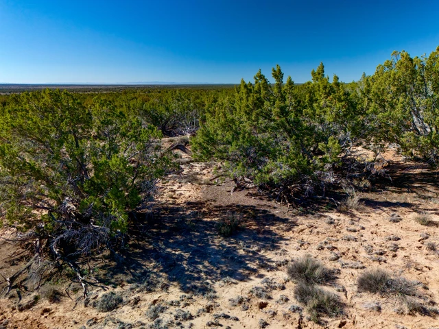
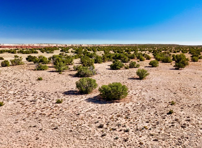
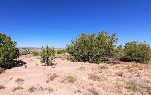
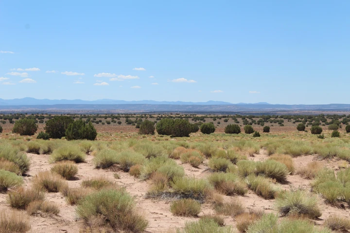
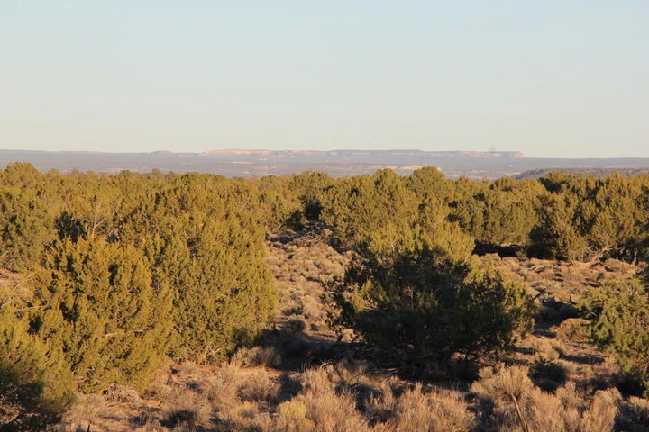
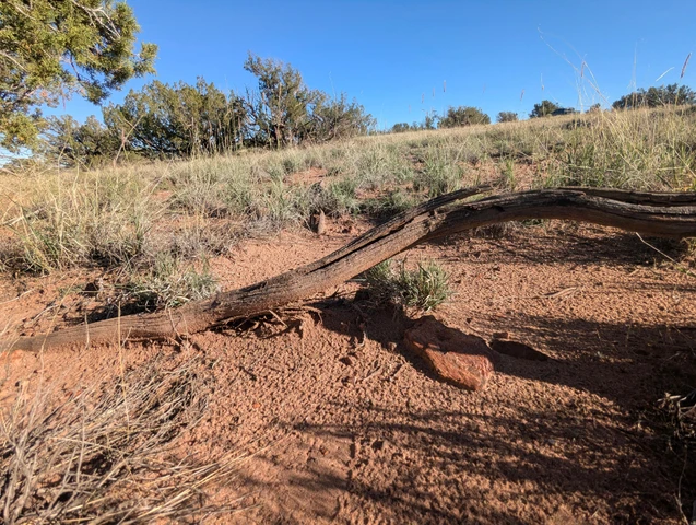
This 20-acre off-grid parcel in Apache County delivers something that's harder to find than the acreage count suggests: real privacy, real views, and real freedom to use the land on your terms. Positioned at 6,600 feet elevation on Arizona's Colorado Plateau, the property features a natural ridge along the northern boundary with long-range views stretching toward Petrified Forest National Park to the west - one of the country's most dramatic and undervisited landscapes. The terrain slopes gently southward through juniper tree coverage that provides shade, wildlife habitat, and a genuine sense of seclusion.
There is no HOA, no POA, and no CCRs here - just Agricultural General zoning, which is about as permissive as Arizona gets. Build a traditional home, a tiny house, an earthship, or an alternative structure. Camp and RV to your heart's content as you plan your next steps. The county welcomes alternative builds and has a well-established permitting process for off-grid development.
Contact us for a drone video, GPS coordinates, and detailed driving directions!
The property is accessed via N7411, an unmaintained dirt road just 4 miles from county-maintained CR7230. High-clearance vehicle recommended. Roads may not be passable during heavy rain.
Off-grid utilities are standard for this area: solar is highly practical with ~275 annual sunshine days, well drilling typically reaches water around 500 feet depth, and a septic system will need to be installed for full-time living.
Petrified Forest National Park is under an hour to the west. Lyman Lake State Park - home to arguably the best walleye fishing in Arizona - is approximately 1 hour 25 minutes away. The Navajo Travel Center in Chambers is the nearest fuel stop (~44 minutes). Gallup, NM offers major shopping about 1 hour 27 minutes east. The property lies within GMU 2A, with over-the-counter elk tags - a significant and increasingly rare advantage for hunters in Arizona.
At a Glance:
20 acres | 6,600 ft elevation | Apache County, AZ
Natural ridge with Petrified Forest views on northern boundary
Juniper tree coverage throughout
Gentle 5.4% southward slope - workable terrain
No HOA / No CCRs / No restrictions
A-General zoning - builds, tiny homes, earthships, RV use all allowed
GMU 2A - over-the-counter elk tags
State Trust Land 3 parcels to the east
4 miles to county-maintained road
Cash: $18,400 | Owner financing available contact us for terms
Ready to see it for yourself? Contact us today for directions!
Details
County: Apache
Zipcode: 85936
Property Type One: Recreational Property
Property Type Two: Residential Property
Property Type Three: Undeveloped Land
Brokerage: Ashbrook Land Company
Brokerage Link: www.ashbrookland.com
Apn: 206-37-004K

Sean Cox
Ashbrook Land Company
(234) 230-6539
By clicking the button, you agree to our Terms of Use and Privacy Policy.


Nearby Listings
Apache County, AZ

$39,900 - 36 ac.
Apache County, AZ
$28,995 - 40 ac.
Apache County, AZ
$11,500 - 2 ac.
Apache County, AZ

$29,800 - 36 ac.
Apache County, AZ
$90,000 - 36 ac.
Apache County, AZ
$48,900 - 36 ac.
Catron County, NM

$89,500 - 140 ac.
Apache County, AZ
$9,195 - 2 ac.
Apache County, AZ
$5,999 - 1 ac.
Apache County, AZ
$6,497 - 2 ac.