
Roundup MT 37.15 Acre Bordering Fed & State Land
TBD Hwy 87, Flatwillow Colony, MT | Lat/Lng: 46.6878, -108.6266
$49,900
37.15 ac.
08/06/2025
ACTIVE

Description
PROPERTY:
This property is only for the adventurer. Looking for an affordable tract of land to get away from it all? How about one that borders nearly 2,000 acres of federal and state land? A 4WD is required in order to off-road for this property as well as the app On-X Hunt to find it. THIS PROPERTY DOES NOT HAVE A ROAD TO IT, WHICH IS WHY IT IS PRICED SO AFFORDABLY.
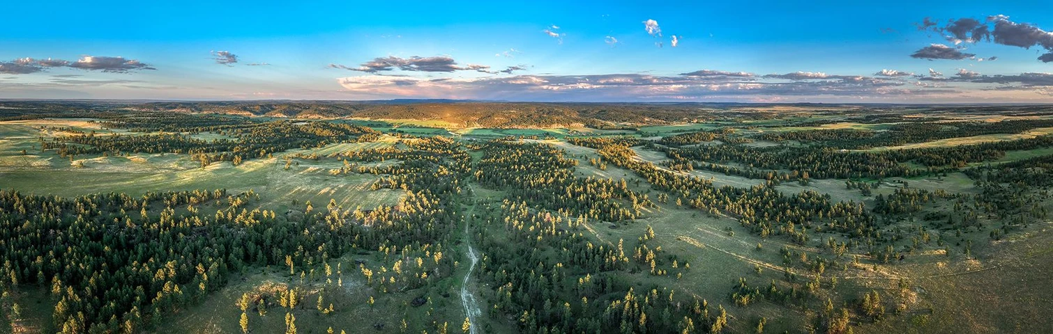
Only a bird’s eye 1 mile from US-87 Hwy, this property is private and remote, ideal for hunting, camping or your favorite recreational activity.
Catty corner is 480 acres of US land and adjacent to that is another 640 acres of State land and two more adjacent parcels of state and federal land make a grand total of 1961 acres of contiguous state and federal land to your property!
If you need a change of pace, your private escape is only 20 minutes away from Roundup for a bite to eat and just over an hour from Billings. Wherever you are located, make this your relaxation and recreational destination as often as you can get away.
Whatever your plans, this property is an amazing investment opportunity. There is no maintenance or upkeep with raw land and the holding cost is low, with property taxes just $125 per year! Private financing is available for deserving buyers with $10,000 down.
This property was purchased with Title Insurance and has a clean title without encumbrances.
PARCEL SPECIFICS:
Size: 37.15 acres
Best Attribute: Freedom! This property is literally “off the beaten path.” Once you find it and know how to get to it, you’ve got 37 acres to hunt, camp, off-road, or any other type of fun you wish to have + nearly 2,000 acres of adjacent federal and state land!
General Location: Roundup, MT
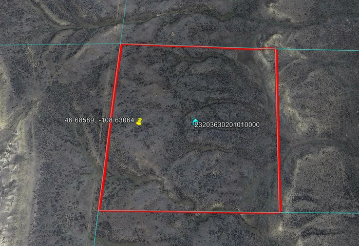
Parcel Number: 23-2036-30-2-01-01-0000
Legal Description: S30, T11 N, R25 E, Sw4 Nw4
GPS Coordinates (approximate):
NE: 46.687847, -108.626562
SE: 46.684232, -108.626568
NW: 46.687843, -108.631445
SW: 46.684228, -108.631462
Property Type: Recreational, Hunting
POA: none
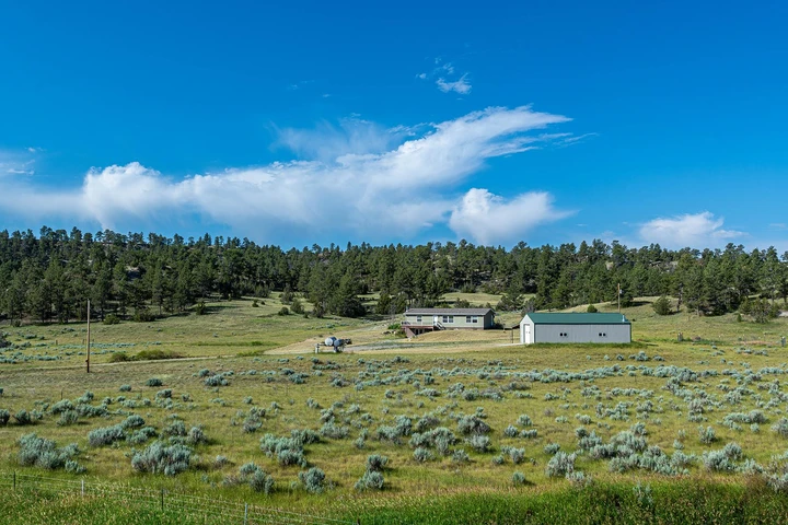
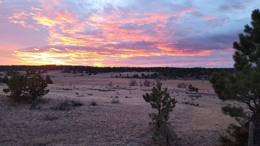
Terrain: Varied terrain with gradual slope from west to east, several flat areas in which to camp and enjoy the amazing territorial views.
Views: Gorgeous mountain views in the distance.
Utilities: None. Enjoy the starry night sky out here!
Access: THERE IS NO ACCESS EASEMENT TO THIS PROPERTY
Title Info: Free & Clear, Conveyed by Flying S Title
Taxes: $125.32, assessed in 2024
Terms: Cash Sale, Conventional Loan and…
Private financing is available for deserving buyers with $10,000 down, $535 P&I for 10 years
Details
County: Musselshell
Zipcode: 59072
Property Type One: Recreational Property
Property Type Two: Undeveloped Land
Property Type Three: Hunting Land
Brokerage: Discover Land Now LLC
Brokerage Link: www.discoverlandnow.com
Apn: 23203630201010000


Nearby Listings
Musselshell County, MT
$12,500,000 - 5692 ac.
Fergus County, MT
$1,150,000 - 23 ac.
Musselshell County, MT

$17,600,000 - 8207 ac.
Musselshell County, MT
$3,100,000 - 1793 ac.
Musselshell County, MT
$500,000 - 80 ac.
Musselshell County, MT

$7,695,000 - 4531 ac.
Fergus County, MT

$3,490,000 - 723 ac.
Musselshell County, MT
$1,500,000 - 722 ac.
Musselshell County, MT

$4,250,000 - 3804 ac.
Musselshell County, MT

$105,000 - 8 ac.