
Eagles Nest to Skyline with Awesome Views
Skyline Drive, Waynesville, NC | Lat/Lng: 35.4853, -82.9996
$79,000
2.58 ac.
02/22/2025
ACTIVE


Description
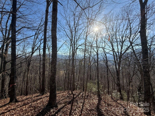
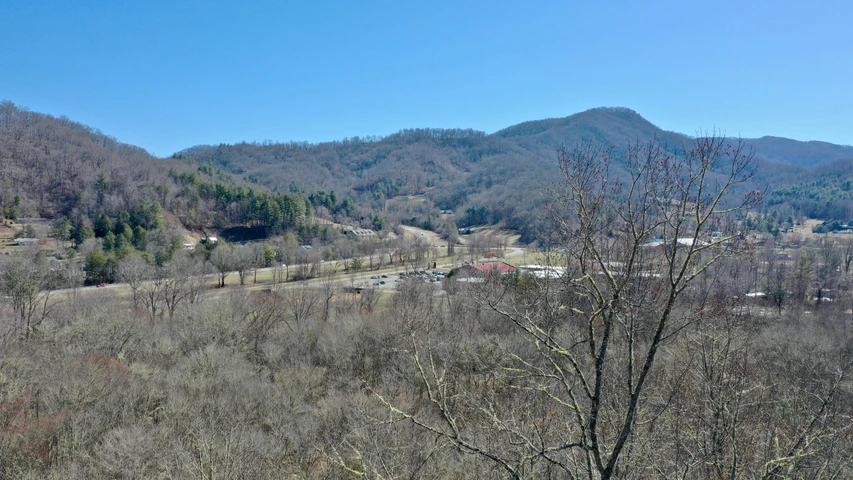
Two lots in the original Eagle's Nest Mountain with great southern exposure and long range views. These lots have been condensed into one parcel which sits high above the town of Waynesville. At 3800' to 4000' elevation, the temps are much more tolerable in the warmer months. In the colder months the snow flurries will be flying much sooner than below. Opportunity for VIEWS in the west from Double Top in nearby Jackson County, to the southern escarpment of Haywood County along the Blue Ridge Parkway from the Waynesville watershed to Mount Pisgah in the east. The approach to a house site would likely allow the driveway to be at the main level of the dwelling. Great investment above the Laurel Ridge CC, 10 min to downtown Waynesville and 35 min to Asheville.
Electric: Duke Energy; Internet: Skyrunner;
Details
County: Haywood
Zipcode: 28786
Property Type One: Residential Property
Property Type Two: Undeveloped Land
Brokerage: RE/MAX Executive
Brokerage Link: https://timothyreeves.remax.com/

Timothy Reeves
RE/MAX Executive
(828) 421-7295
By clicking the button, you agree to our Terms of Use and Privacy Policy.


Nearby Listings
Madison County, NC
$19,900 - 2 ac.
Buncombe County, NC

$1,895,000 - 125 ac.
Haywood County, NC
$198,111 - 17 ac.
Buncombe County, NC

$108,240 - 0 ac.
Jackson County, NC
$1,475,000 - 27 ac.
Jackson County, NC

$24,900 - 2 ac.
Buncombe County, NC

$1,895,000 - 125 ac.
Jackson County, NC
$4,600,000 - 990 ac.
Jackson County, NC
$275,000 - 24 ac.
Jackson County, NC
$1,785,000 - 60 ac.