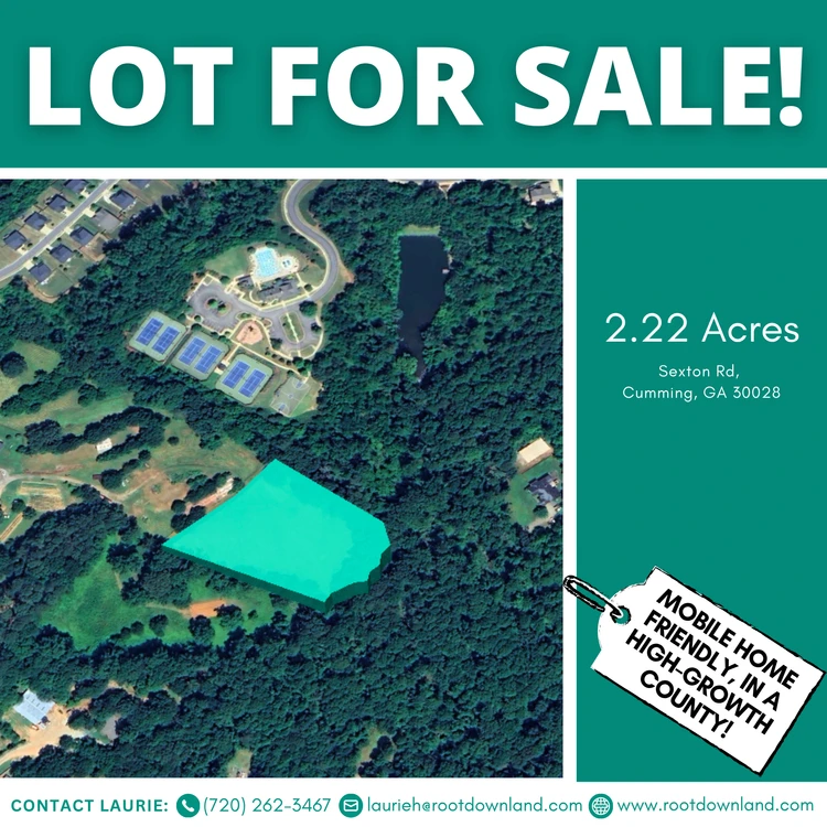
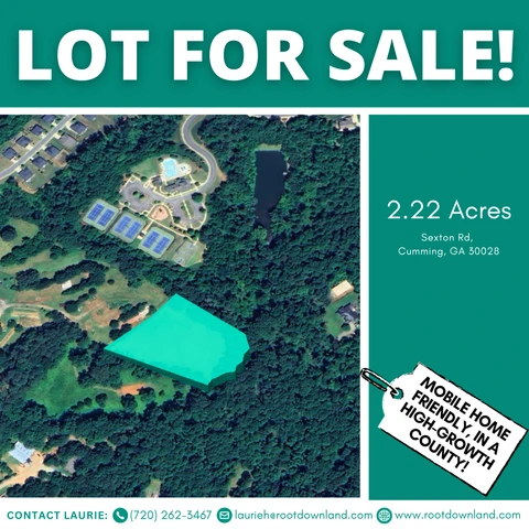
2.22 Acres in Forsyth County, GA — No HOA | A-1 Zoning | Near Cumming
Sexton Rd, Matt, GA | Lat/Lng: 34.3023, -84.1712
$128,000
2.23 ac.
11/21/2025
ACTIVE
Description
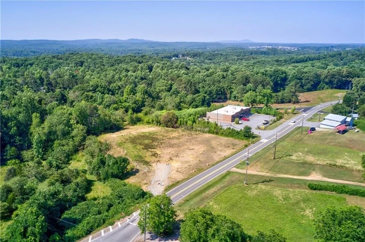
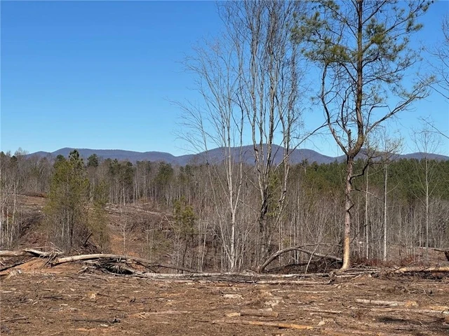
This 2.22-acre parcel off Sexton Road offers a rare mix of privacy, usable land, and proximity to everything that makes Forsyth County desirable.
The property is mostly cleared with gentle slopes and light woods, making it well-suited for a thoughtfully placed homesite without the feeling of being boxed in. There’s enough space here to build a single-family home, add accessory structures, or create a small homestead setup — all without HOA restrictions or subdivision rules.
Zoned Agricultural (A-1), the land supports a single-family residence, accessory buildings, or a code-compliant mobile home. It’s a practical option for buyers who want flexibility without sacrificing location or long-term value.
LAND, ACCESS & UTILITIES
Access is provided via easement from Sexton Road, offering separation from traffic while maintaining legal access.
Utilities and infrastructure planning are straightforward for rural Forsyth County:
Well and septic will be needed
Electric service available through Sawnee EMC
The terrain allows for multiple build orientations, giving you control over privacy, views, and layout.
LOCATION HIGHLIGHTS
While the property feels quiet and removed, you’re still close to daily essentials and outdoor recreation:
Minutes from Sawnee Mountain Preserve and local trails
Short drive to Cumming, schools, shopping, and dining
Located in a county known for strong demand and stable property values
This balance of space and convenience is becoming harder to find in Forsyth County.
PROPERTY LOCATION
Address: Sexton Rd, Cumming, GA 30028
County: Forsyth
State: Georgia
?? Center GPS Coordinates:
34.30231, -84.17115
?? Directions:
Start with 6270 Sexton Rd, Cumming, GA to get close.
Then enter the GPS coordinates above to locate the property precisely.
PROPERTY DETAILS
Parcel Number: 094-000-229
Parcel Size: 2.22 Acres
Zoning: Agricultural (A-1)
Property Type: Vacant Land
Subdivision: None — No HOA
Terrain: Gently sloped, mostly cleared, lightly wooded
Annual Taxes: $1,630.53 (current)
GPS Corner Coordinates:
NE: 34.3027, -84.1706
SE: 34.3021, -84.1707
SW: 34.3019, -84.1719
NW: 34.3027, -84.1717
Legal Description: 3 1 341 Tr 2
NEXT STEPS
We keep the purchase process clear and professional.
Closing handled through a trusted third-party title company
Clear communication from start to finish
No pressure — confirm the fit before moving forward
Message or call today to ask questions or secure the property.
IMPORTANT DISCLOSURES
Buyer must complete their own due diligence. Property is sold as-is. All information provided is believed to be accurate but is not guaranteed. Buyer is responsible for verifying zoning, access, boundaries, permitted uses, utilities, easements, and development requirements with Forsyth County. Utilities may require additional connection costs. Some photos may represent the surrounding area and not the exact parcel.
Seller holds equitable interest and makes no warranties or representations regarding land condition, utility availability, or development feasibility.
Details
County: Forsyth
Zipcode: 30040
Property Type One: Recreational Property
Property Type Two: Residential Property
Property Type Three: Undeveloped Land
Brokerage: Root Down Land
Brokerage Link: www.rootdownland.com
Apn: 094 229

Laurie Halter
Root Down Land
(720) 262-3467
By clicking the button, you agree to our Terms of Use and Privacy Policy.


Nearby Listings
Gilmer County, GA

$189,900 - 4 ac.
Gilmer County, GA
$129,900 - 2 ac.
Pickens County, GA

$2,320,014 - 357 ac.
Gilmer County, GA

$139,900 - 4 ac.
Gilmer County, GA
$149,900 - 5 ac.
Gilmer County, GA

$49,900 - 1 ac.
Dawson County, GA
$750,000 - 5 ac.
Dawson County, GA

$2,175,000 - 107 ac.
Lumpkin County, GA
$419,900 - 14 ac.
White County, GA
$600,000 - 24 ac.