
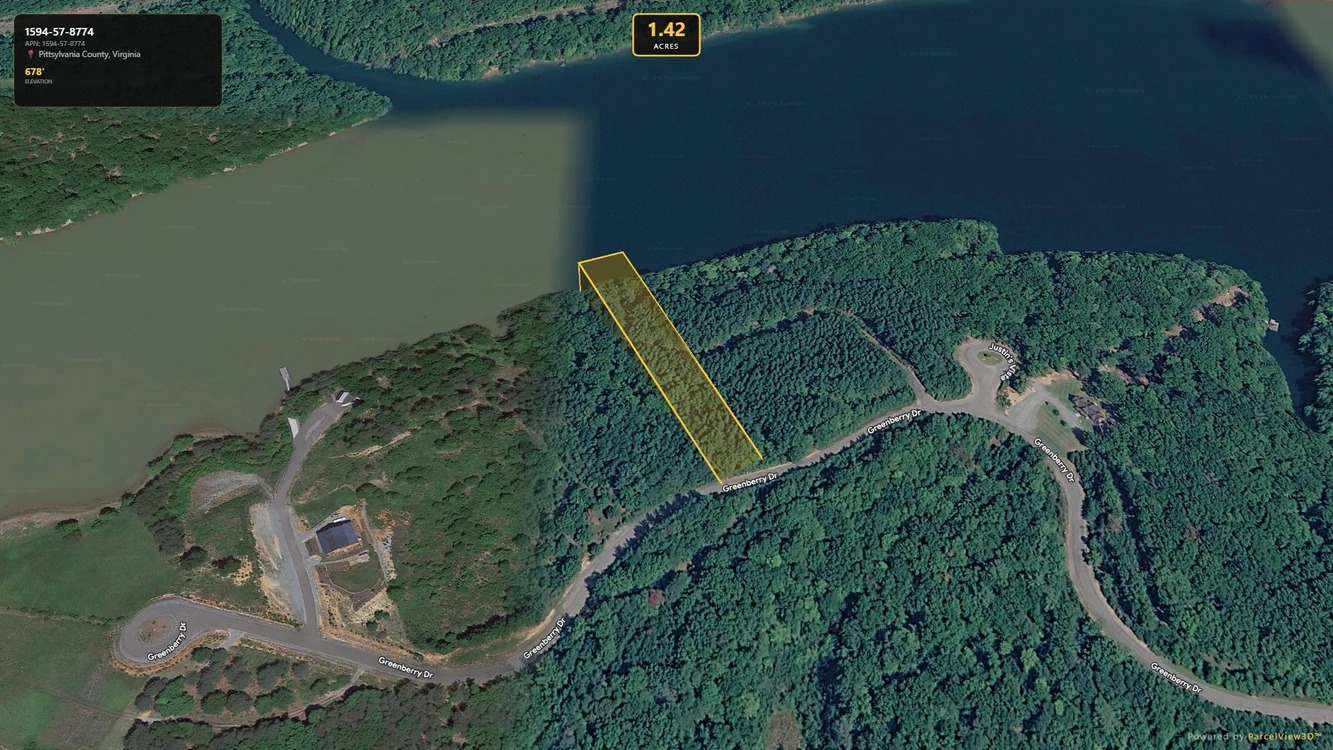
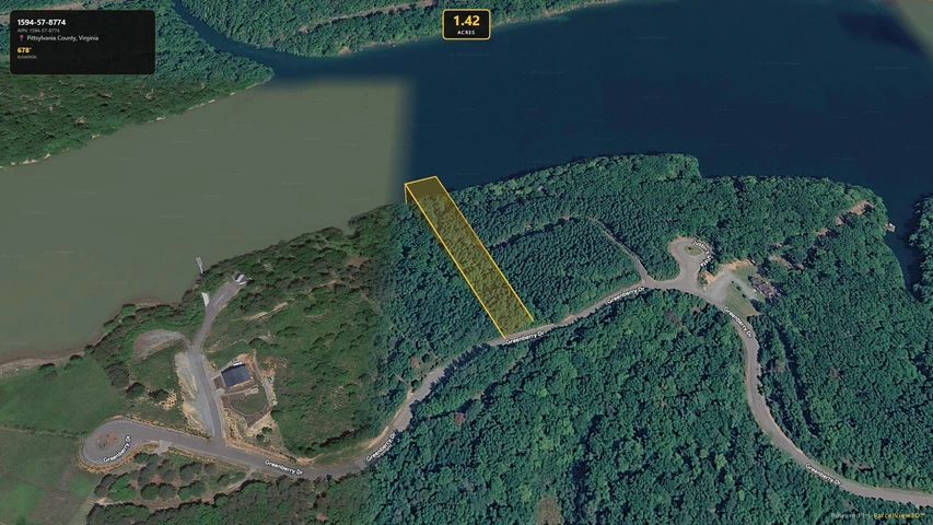
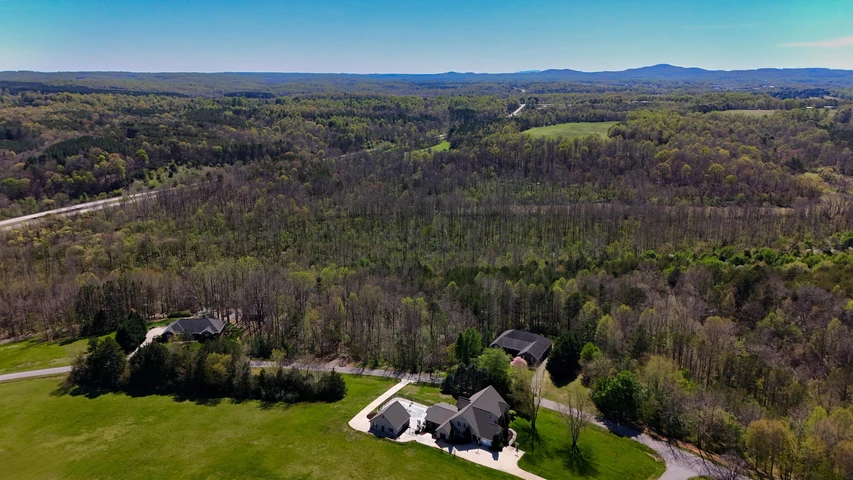
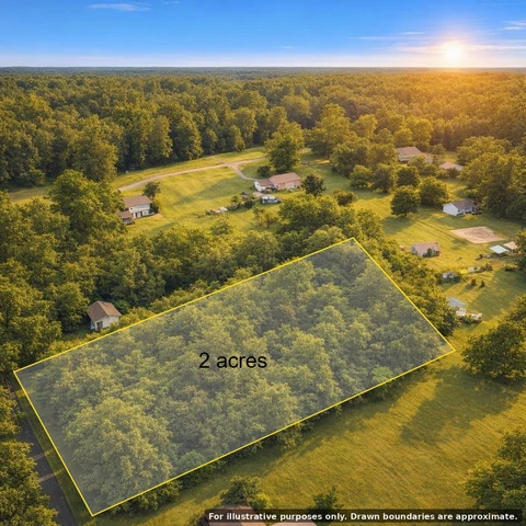
Experience Leesville Lake ownership on this 1.42‑acre lot in Eagle Pointe
Pittsville, VA | Lat/Lng: 37.0626, -79.4838
$43,000
1.42 ac.
06/17/2026
ACTIVE
Description
1.42 Acre Lot Lot115, EaglePointeShoresDr, Pittsville, VA24139
Property facts
Aspect
Details
Acreage (approx.)
~1.42acres (61,753ft).
Parcel ID / Legal description
Pittsylvania County parcel 1594-57-8774 (EaglePointeShoresSubdivision, Section2, Lot115).
Address & coordinates
Lot115 EaglePointeShoresDr, Pittsville, VA24139. Approx. 37.06255, -79.4838 (use these coordinates in GoogleMaps to locate the property).
Road frontage & depth
About 100ft of paved road frontage along EaglePointeShoresDr with an estimated ~620ft depth (calculated from the lot area).
Topography & land cover
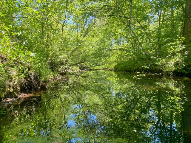
The lot is gently sloping and mostly wooded. Similar waterfront lots in the subdivision have lake and mountain views and gentle terrain.
Zoning
Residential Planned Development (RPD) zoning (Pittsylvania County).
Taxes (estimate)
Approximately $196yr (based on similar 1.22 acre lot taxes).
Utilities
Underground electric and phone lines are available within EaglePointeShores. Owners typically install a well and septic system for water and sewer; cable/internet may be available through local providers.
Subdivision & HOA
The lot lies inside the EaglePointeShores gated community. Amenities include a community boat ramp and dock, picnic pavilion, hiking trails, fishing pier, paved roads, and underground utilities. HOA dues are ~$800850yr for similar lots. Community & amenities
EaglePointeShores is an upscale gated community on the northern arm of LeesvilleLake. Residents enjoy:
Boat ramp and dock access: community launch ramp with fishing pier and boat docks.
Underground utilities & paved roads: utility lines are buried and wide roads are paved for easy access.
Picnic pavilion & hiking trails: a lakeside picnic pavilion and miles of walking trails through mature hardwoods.
Additional boat storage: dedicated storage area for trailers and recreational equipment.
Privacy: the development is gated and features low density home sites.
PROPERTY DETAILS
APN: 1594-57-8774
Size: 1.42 Acres
County: Pittsylvania
State: Virginia
Terrain: Gently Sloped
ENVIRONMENTAL FACTORS
Fire Risk: Minimal Open water (1/10)
Flood Risk: Minimal (1/10)
Heat Risk: Moderate (5/10)
Wind Risk: Moderate (3/10)
Sources:
Fire -- USFS Wildfire Hazard Potential
Flood -- FEMA National Flood Hazard Layer
Heat -- NOAA Climate Normals
Wind -- NOAA HURDAT
GPS COORDINATES
GPS Center: 37.0625584, -79.4838340
Details
County: Pittsylvania
Zipcode: 24139
Property Type One: Undeveloped Land
Brokerage: GatewayLandInvestments.com
Brokerage Link: https://parcelview3d.com/portfolio-view/?customer=1
Apn: 1594-57-8774

Gateway LLC
GatewayLandInvestments.com
(434) 216-7826
By clicking the button, you agree to our Terms of Use and Privacy Policy.


Nearby Listings
Halifax County, VA
$399,000 - 42 ac.
Pittsylvania County, VA

$64,900 - 11 ac.
Franklin County, VA
$99,900 - 14 ac.
Pittsylvania County, VA

$119,900 - 10 ac.
Henry County, VA
$32,850 - 2 ac.
Pittsylvania County, VA
$149,900 - 20 ac.
Franklin County, VA

$299,900 - 15 ac.
Franklin County, VA
$67,000 - 6 ac.
Roanoke County, VA
$44,500 - 2 ac.
Franklin County, VA

Auction - 116 ac.