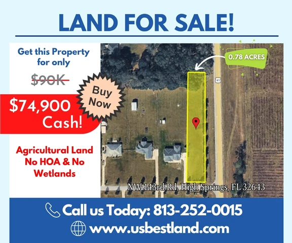
0.78 acres in Alachua County, FLorida
Northwest 143rd Road, High Springs, FL | Lat/Lng: 29.7877, -82.6084
$74,900
0.78 ac.
06/12/2026
ACTIVE

Description
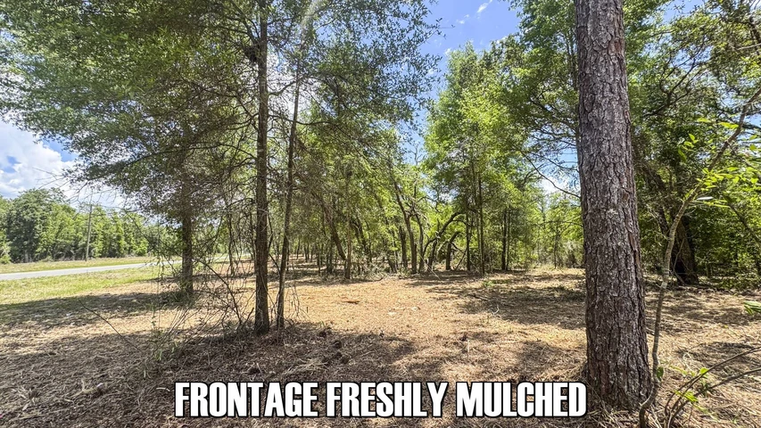
Build your dream home on this beautiful 0.78-acre homesite in desirable Alachua County. Zoned Agricultural, the property allows for a single-family residence, including site-built, modular, or mobile homes, offering excellent flexibility for your build.
Enjoy peaceful living just minutes from High Springs and a short drive to Gainesville, with convenient access to shopping, dining, schools, healthcare, and outdoor recreation.
With no HOA restrictions or fees, no wetlands, and not located in a flood zone, this property provides a rare opportunity to build with fewer limitations in a growing North Florida area.
Ideal for a primary residence, weekend retreat, or long-term investment—this is your chance to own land in beautiful Alachua County.
Live the Florida lifestyle! Secure this 0.78-acre lot for $74,900 (17% off) and start building the home you’ve always wanted. Act now before it’s gone!
++++ PURCHASING OPTIONS ++++++++++
Cash: You pay only $74,900!
No Seller Financing Available.
++ PROPERTY INFO ++
Parcel # (APN): 01538-004-012
Legal Description: TAMIAMI HEIGHTS UNIT 1 PB A PG 174 LOTS 19 THRU 36 BK 5 & 12 FT ALLEY ADJ ON W LESS R/W ON E OR 4899/1791
Parcel Size: 0.78 acres
Approximate Dimensions: 76.58 ft x 502.38 ft x 76.58 ft x 502.38 ft
++ LOCATION ++
Address: NW 143rd Rd, High Springs, FL 32643
GPS Center Coordinates:
29.787732, -82.608403
GPS Coordinates (Corners):
29.787109, -82.608513
29.787114, -82.608289
29.788425, -82.608293
29.788423, -82.608516
Driving Directions:
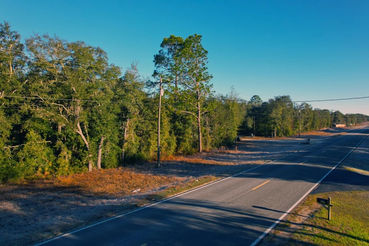
From Gainesville, head north on NW 6th Street and continue onto US Highway 441. Continue north, then turn left onto US Highway 41. Turn right onto NW 143rd Road toward the property. The property is approximately 18–20 miles from Gainesville and will be on the right-hand side.36th Terrace, left again onto SE 15th Place, and finally turn right onto SE 37th Street, where your destination will be on the right.
Elevation: 77 feet
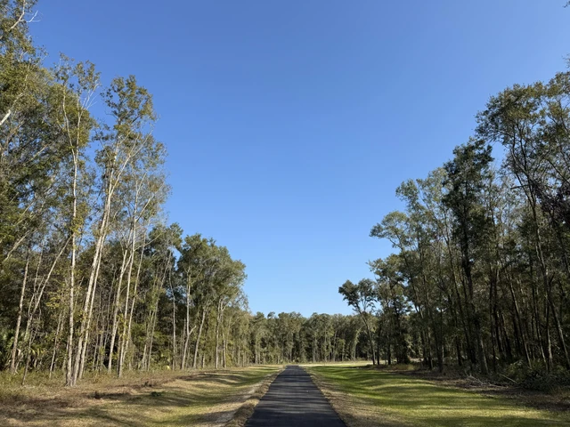
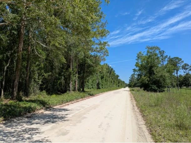
Property Access: Paved road access
++ OTHER PROPERTY INFORMATION ++
Annual Property Taxes: $1219.94
Access to Property: Legal and Physical Access
Road Surface Type: Paved road
Terrain Type: Flat
++ NEARBY ++
Closest Major City: Gainesville, FL - 38 min (26.9 miles)
Nearby Attractions:
High Springs Museum - 6 min (3.1 miles)
River Ranch Water Park - 12 min (5.96 miles)
Poe Springs Park - 9 min (5.6 miles)
Rum Island Springs County Park - 15 min (9.7 miles)
Devil's Ear Spring - 17 min (10.7 miles)
Ginnie Springs Outdoors, LLC - 14 min (10.3 miles)
Hill top wood - 11 min (8.7 miles)
Historic Main Street Alachua - 14 min (miles)
Zip at Haile Quarry - 15 min (11.2 miles)
++ BUILDING / USAGE ++
Zoning: Agricultural
What can be built on the property? Single-family residence and site-built home, modular home, or place a mobile home.
++ UTILITIES ++
Water? Well is needed
Sewer or Septic? Septic is needed
Electric? Available in the area, but not yet connected
Details
County: Alachua
Zipcode: 32643
Property Type One: Undeveloped Land
Brokerage: USBestLand
Brokerage Link: usbestland.com
Apn: 01538004012

David Hans
USBestLand
(813) 252-0015
By clicking the button, you agree to our Terms of Use and Privacy Policy.


Nearby Listings
Levy County, FL
$19,999 - 0 ac.
Gilchrist County, FL

$1,035,000 - 5 ac.
Marion County, FL

$399,910 - 14 ac.
Marion County, FL
$290,000 - 10 ac.
Marion County, FL

$1,999,000 - 59 ac.
Suwannee County, FL
$73,995 - 4 ac.
Marion County, FL
$7,800,000 - 109 ac.
Levy County, FL
No Price - 11971 ac.
Columbia County, FL
$234,900 - 1 ac.
Levy County, FL
$449,000 - 40 ac.