
Conway 63.41
Hwy 95, Morrilton, AR | Lat/Lng: 35.2602, -92.7345
$575,000
63.41 ac.
08/20/2025
ACTIVE

Description
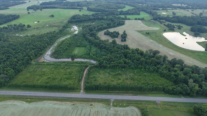
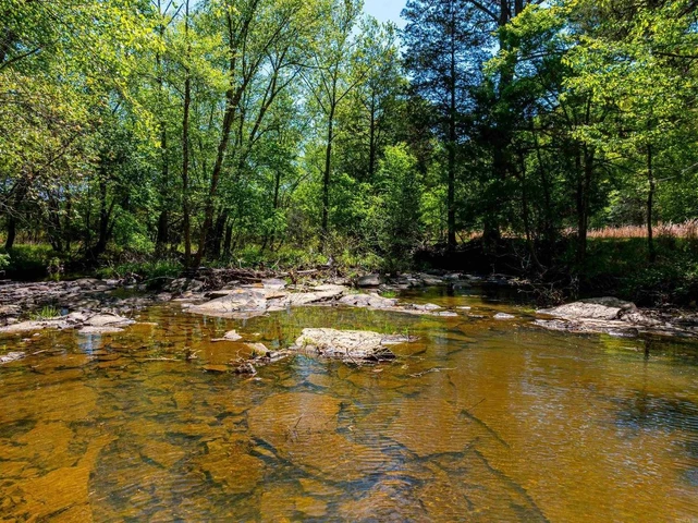
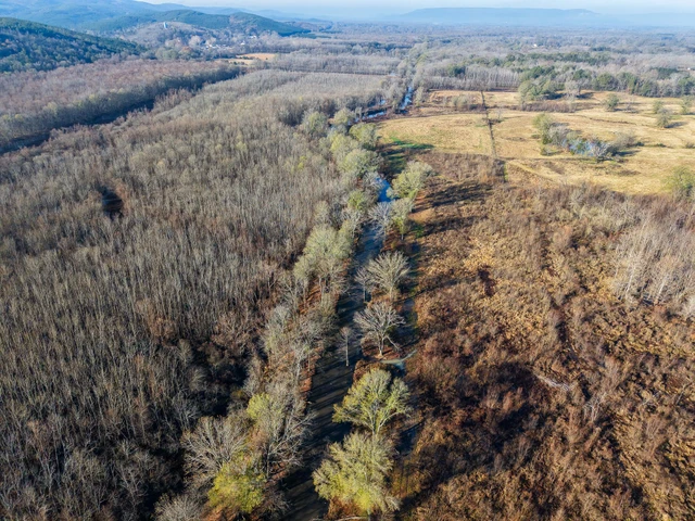
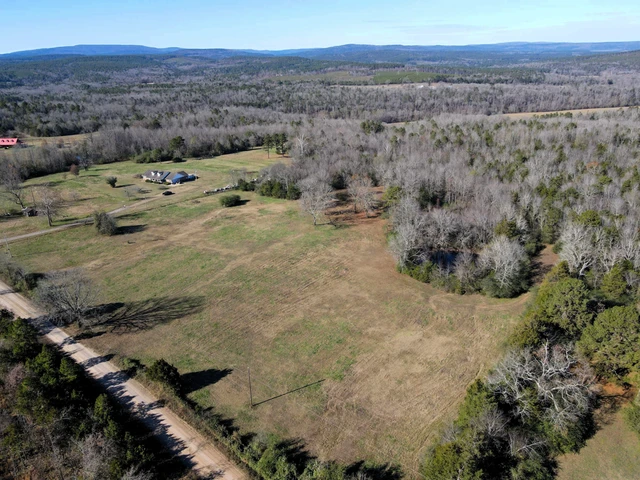
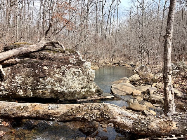
Welcome to the Conway 63.41, located near the Ed Gordon Wildlife Management Area, a well-known waterfowl impoundment in Central Arkansas. This 63.41 acre Conway County tract is as unique of a waterfowl property as you will find for miles around. The vision that started from a hayfield to what it is today is truly amazing. The owners saw it for what it could be and made every effort to make that dream a reality.
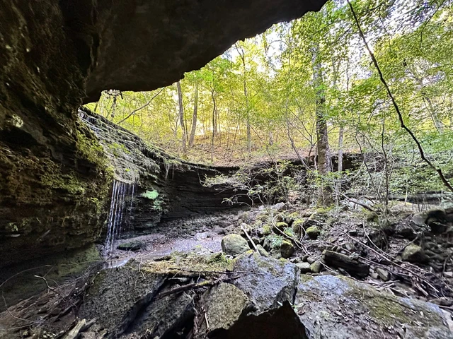
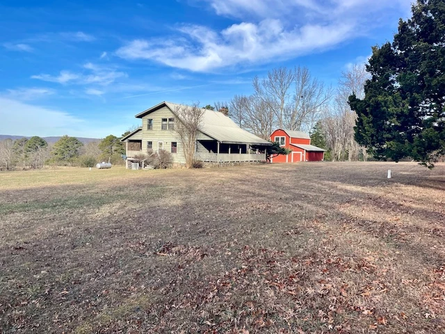
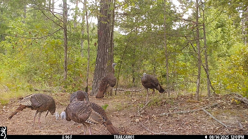
The Conway 63.41 is one of only a few properties enrolled in WRP in proximity to the Ed Gordon WMA. This property can be naturally and mechanically flooded by a pump from Point Remove Creek, which makes up the northern boundary. With several duck blinds in place, you have many options for getting your daily limit, each being a known producer. This property is not only a waterfowl haven; it offers the same opportunities for the deer hunter looking for a year-round place to manage the local herd. There are multiple stand locations and food plots already in place, ready for the next owner to take over. Also situated on the property is an off-grid cabin that has been set on concrete piers to avoid any flooding and offer the potential for a camp to be shared with friends and family for years to come.
This unique property offers many features not found anywhere else. The first being the unencumbered road system and campsite not subject to the WRP, maintain it as you prefer. A second feature is the ability to utilize the moist soil areas that have been approved as food plot sites. Finally, the feature that tips the scale is the ability to navigate Point Remove Creek by boat to the Ed Gordon WMA.
Don't let this amazing place get by you for this upcoming season. Let's take a tour TODAYcontact Luke Alston or Tom Fooshee and schedule a private visit of the Conway 63.41.
Location:
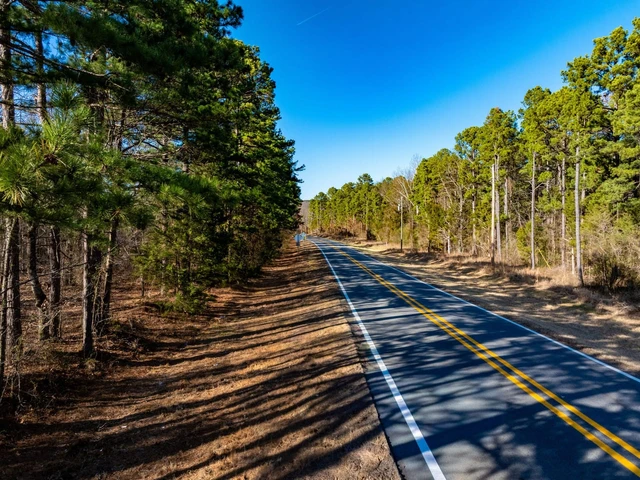
Hwy 95
Morrilton, AR 72110
Conway County
1.2 Miles As the Duck Flies
to Ed Gordon WMA
4.8 Miles N of Overcup Lake
6 Miles N of Morrilton
10.8 Miles N of
the Arkansas River
33 Miles W of Lake Dardanelle
60 Miles NW of
the Little Rock Airport
Coordinates:
35.26025, -92.73454
Property Use:
Hunting/Fishing
Cabin
Recreational
Investment
Property Information:
63.41 Acres
WRP Enrolled for Perpetuity
Internal Roads and Campsite Unencumbered by Easement
Moist Soil Management Techniques in Place
Point Remove Creek
is Northern Boundary
Navigable to Ed Gordon
WMA by Boat
Duck/Deer Blinds Convey
Frontage on Hwy 95
Off-Grid Cabin
Flooding Impoundments
with Risers
Approved Pump for Pulling Water from Point Remove Creek
Tax Information:
Parcel 001-05085-000: $144
Details
County: Conway
Zipcode: 72110
Property Type One: Recreational Property
Property Type Two: Hunting Land
Brokerage: Smalltown Hunting Properties & Real Estate
Brokerage Link: https://smalltownproperties.com/agent/tom-fooshee/
Apn: 00105085000

Tom Fooshee
Smalltown Hunting Properties & Real Estate
(479) 588-1034
By clicking the button, you agree to our Terms of Use and Privacy Policy.


Nearby Listings
Van Buren County, AR
$390,000 - 175 ac.
Van Buren County, AR
$1,300,000 - 220 ac.
Pulaski County, AR
$2,240,000 - 40 ac.
Van Buren County, AR
$992,000 - 160 ac.
Faulkner County, AR
$899,000 - 3 ac.
Perry County, AR
$695,000 - 165 ac.
Conway County, AR
$149,744 - 44 ac.
Van Buren County, AR
$220,000 - 110 ac.
Conway County, AR
$465,000 - 144 ac.
Cleburne County, AR
$138,500 - 22 ac.