
28 Acre Perry County IN Hunting Land With Cabin
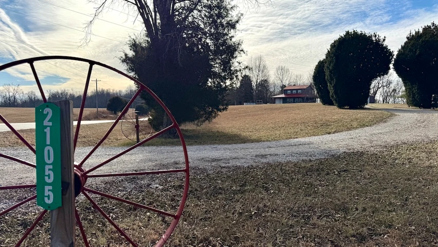
21055 Sr 66, Mount Pleasant, IN | Lat/Lng: 38.1501, -86.5035
$474,900
28 ac.
01/22/2026
ACTIVE

Description
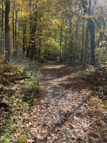
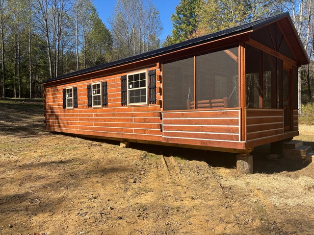
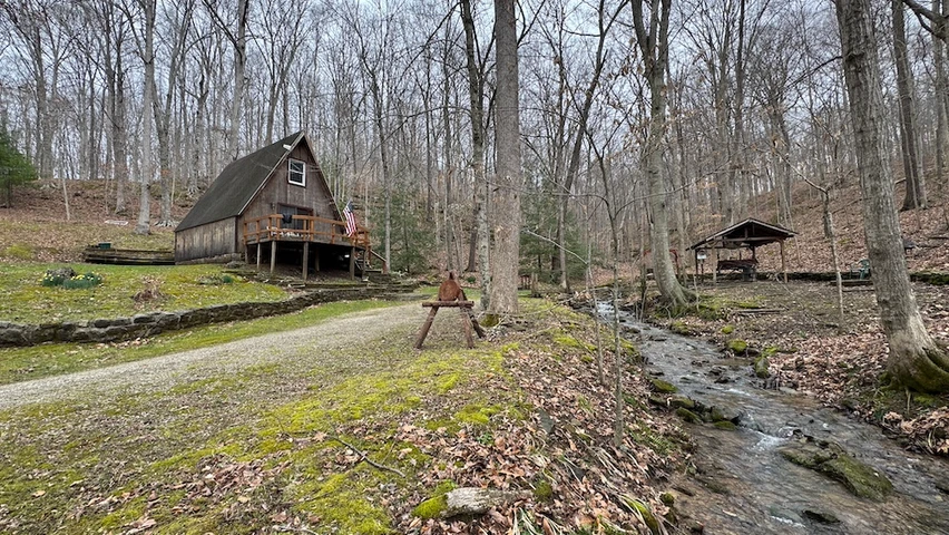
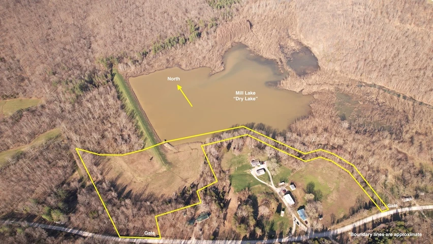
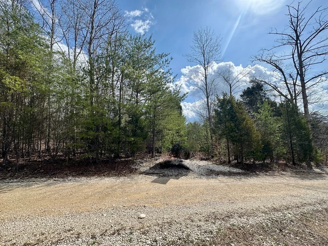
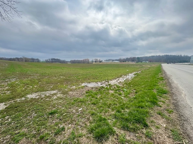
Located at 21055 SR 66 in Mount Pleasant, Indiana, this 28-acre wooded property sits in northeastern Perry County just south of Oriole. The property is accessed from State Road 66 and set back from the highway, offering privacy with no nearby residences in view. The land features mature hardwood timber, rock outcroppings, interior trails, and a fully improved cabin suitable for recreational or extended use.The cabin offers approximately 1,152 square feet of finished living space, including four bedrooms and one and a half bathrooms. The layout includes ground-level laundry, a full kitchen, and multiple storage areas that support longer stays or seasonal use. Utilities are in place, including water service from Patoka Regional Water District, electric through Southern Indiana Power, and internet service provided by PSC. The propane tank is owned and was recently filled at the time of photography.A 24-by-24-foot wraparound porch provides outdoor living space and overlooks the surrounding wooded acreage. Two garage spaces, each approximately 200 square feet, offer enclosed storage for recreational equipment, tools, and seasonal items. A separate garden shed provides additional organized storage for lawn equipment and maintenance tools.The land is primarily wooded, with mature hardwood timber consisting largely of white oak. Based on current conditions, the timber is expected to be suitable for harvest in approximately ten years, subject to market conditions and professional evaluation. The terrain includes notable rock outcroppings that transition into a natural drainage with additional exposed rock formations and seasonal waterfalls. These features contribute to the overall character of the property and provide opportunities for outdoor exploration.An established trail system allows access throughout the property by foot, ATV, or UTV, reaching the far corners of the acreage with ease. Neighboring properties to the south and west have recently undergone timber harvest, while agricultural fields to the north provide edge habitat. The surrounding land use supports consistent wildlife movement across the area, making the property well-suited for hunting, wildlife observation, and general recreational use.The location provides convenient access to nearby towns and regional destinations while maintaining a rural setting. The property is approximately 6 miles from Sulphur, 7 miles from Interstate 64, 22 miles from Tell City, 29 miles from Corydon, and about 45 miles from New Albany. This combination of access, improvements, and land features makes the property suitable for a variety of recreational and rural use objectives.Agent Notes: Property is partially enrolled in the classified forest program.
Details
County: Perry
Zipcode: 47520
Property Type One: Recreational Property
Property Type Two: Residential Property
Property Type Three: Timberland
Brokerage: Whitetail Properties Real Estate
Brokerage Link: www.whitetailproperties.com/agents/zach-holt
Apn: 620622400007000004

Zach Holt
Whitetail Properties Real Estate
(812) 887-2954
By clicking the button, you agree to our Terms of Use and Privacy Policy.


Nearby Listings
Orange County, IN

$295,900 - 50 ac.
Crawford County, IN
$221,150 - 44 ac.
Orange County, IN
$395,900 - 80 ac.
Crawford County, IN
$424,900 - 42 ac.
Orange County, IN

$569,900 - 70 ac.
Perry County, IN
$70,000 - 10 ac.
Orange County, IN
$69,900 - 10 ac.
Martin County, IN
$164,900 - 14 ac.
Martin County, IN

$49,900 - 5 ac.
Washington County, IN

$85,000 - 9 ac.