
±52.51 Acres on Sulphur Creek, Lampasas, Texas
1502 East 3rd Street, Lampasas, TX | Lat/Lng: 31.0710, -98.1696
$3,500,000
52.51 ac.
06/10/2026
ACTIVE

Description
52.51 Acres on Sulphur Creek with a house, barn/guest quarters and 144 ac-ft. of adjudicated water rights in Lampasas, Texas. Additional acreage available...
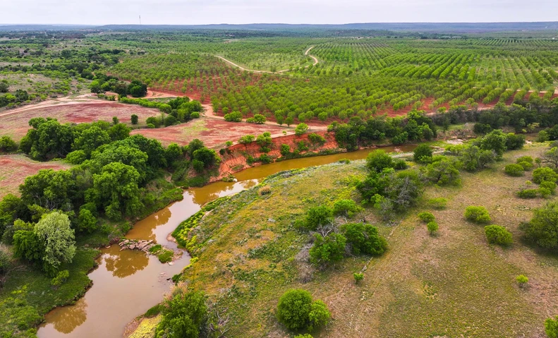
LOCATION/FRONTAGE: The property is located at 1502 E. 3rd Street, being along the east side of E. 3rd Street and both sides of Sulphur Creek in Lampasas, Texas. The property has about 1,154 feet of frontage along E. 3rd Street, ±2,510 feet of frontage along Sulphur Creek and ±2,220 feet of frontage along both sides of Gibson Branch. Adjacent 26.53 acres is also available for potential ±79-acre assemblage. Contact Broker for more information.
LEGAL: 52.51 acres out of the John Burleson Survey, Abstract No. 42 and portions of Lots 5, 6, 7 & 8, Block 7 of the Mathew Wilkes Addition in Lampasas, Lampasas County, Texas.
UTILITIES: All utilities to the site with City of Lampasas water (6-inch) and sewer (10-inch) lines being along E. 3rd Street in front of the property. Electricity is in place at the house and barn.
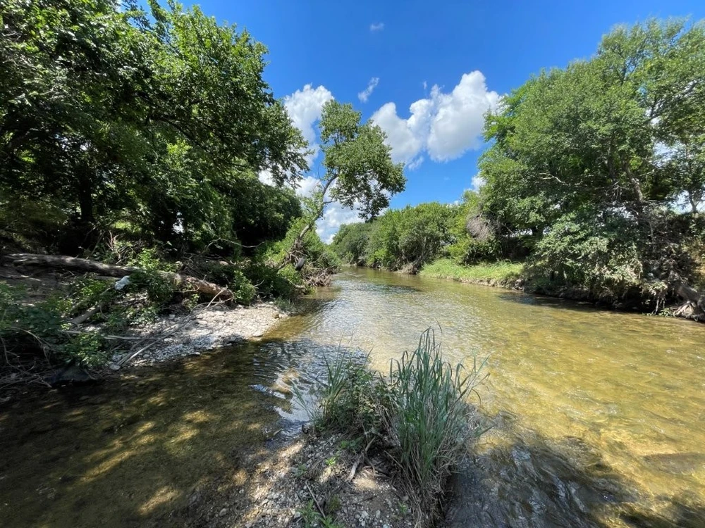
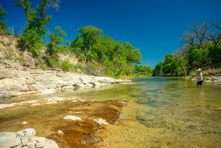
ADJUDICATED WATER RIGHTS: The property includes adjudicated water rights out of Sulphur Creek authorizing diversion and use of 144 acre-feet per year for agricultural purposes to irrigate 41 acres of the property. The permit is issued by the Texas Commission on Environmental Quality (TCEQ) and recorded as Certificate No. 12-2974. The priority date for the subject’s adjudicated right is May 11, 1913. Based on a review of TCEQ’s water rights database, the property's water rights appear to be the most senior along Sulphur Creek.
ZONING: The property is located within the Lampasas city limits. Approximately 49 acres is zoned Agriculture (AG) with the remaining ±3½ acres situated at the northwest corner being zoned Single-Family Residential (SF-6). According to the Lampasas Future Land Use map, the property is planned for Suburban Residential uses.
SCHOOL DISTRICT: Lampasas ISD
TAXES: Agriculture Use Valuation on 52.51 acres – Buyer responsible for any roll-back taxes upon change of use. Lampasas CAD Parcel No. R8163.
MINERALS (OIL & GAS): Owner believed to have a partial interest in the mineral estate.
FLOOD PLAIN: The property contains about 32 acres (±61%) within the 100-year floodplain according to FEMA Panel No. 480430 0005B effective June 15, 1982.
EASEMENTS: Typical utility easements for water, sewer, electricity and telephone service are assumed.
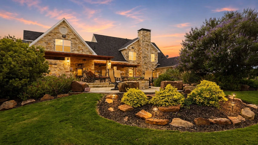
IMPROVEMENTS: The property contains a 2,108 SF one-story house built in 2019. The dwelling represents wood frame construction supported by a concrete slab foundation and covered by a sheet metal roof with wood siding exterior walls. A covered wrap-around porch surrounds 2½ sides of the house, containing 792 SF. The floorplan provides three bedrooms and 2½ baths with an office which could be used as a fourth bedroom. Interior finish-out includes vinyl plank floor coverings, painted/textured walls, wood panel ceilings, wood cabinets and granite countertops. A central HVAC unit provides interior climate control and is supplemented by ceiling fans. The owner occupies the dwelling as a full-time primary residence, so showings need to be scheduled in advance with listing broker.
There is also a workshop with living quarters located southwest of the house. This structure contains 3,250 SF under roof divided into a 650 SF two bedroom-one bath living quarters, a 600 SF enclosed workshop and various covered work and storage areas. The apartment space is heated and cooled by a central HVAC system with finish-out consisting of vinyl plank floor coverings, laminate countertops and painted/texture walls and ceilings. The south and east sides of the workshop contain open-sided extensions which provide an additional 2,550 SF of covered parking and storage space.
Covered pens are situated west of the workshop and provide a functional work area for livestock projects and maintenance of agricultural use valuation for ad valorem taxes.
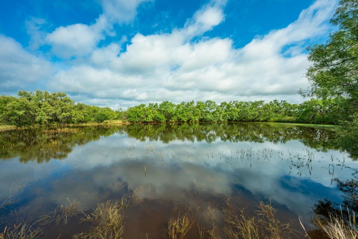
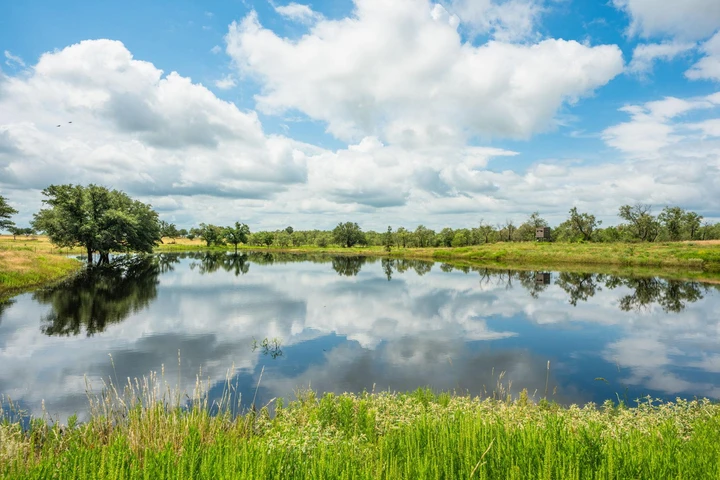
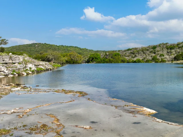
COMMENTS: The land mix is composed of about two-thirds wooded native pasture with an open tillable field on the balance. Tree cover consists of a mixture of oak, elm, mesquite and pecan trees. The terrain is mostly level with moderate-to-steep slopes along riparian areas. Sulphur Creek forms the property’s eastern boundary providing perennial spring-fed water flows over mud and gravel bottoms. Gibson Branch meanders through the property’s central portion offering wet-weather flows as it crosses the tract’s northwestern portion with modest spring-fed flows on the southeastern portion before converging with Sulphur Creek. The tillable field on the southwest portion is irrigated from Sulphur Creek and is periodically planted in small grains.
Details
County: Lampasas
Zipcode: 76550
Property Type One: Recreational Property
Property Type Two: Residential Property
Property Type Three: Riverfront Property
Brokerage: Mays Landmark Real Estate Services, LLC
Brokerage Link: www.mayslandmark.com
Apn: 8163

Michael Mays
Mays Landmark Real Estate Services, LLC
(737) 340-5182
By clicking the button, you agree to our Terms of Use and Privacy Policy.


Nearby Listings
Lampasas County, TX
$7,844,000 - 293 ac.
Llano County, TX
$8,425,660 - 847 ac.
Llano County, TX
$2,815,120 - 176 ac.
San Saba County, TX
$28,000,000 - 3300 ac.
Mills County, TX
$1,200,000 - 3 ac.
Burnet County, TX
$11,995,000 - 1834 ac.
Lampasas County, TX
$3,477,420 - 386 ac.
Burnet County, TX
$10,950,000 - 643 ac.
Lampasas County, TX
No Price - 1555 ac.
Lampasas County, TX
$3,750,000 - 387 ac.