120-Acre Wayne County Recreational Property
123 Teasdale Powerline Road, Teasdale, UT | Lat/Lng: 38.2937, -111.4556
$1,250,000
122 ac.
06/24/2025
ACTIVE

Description
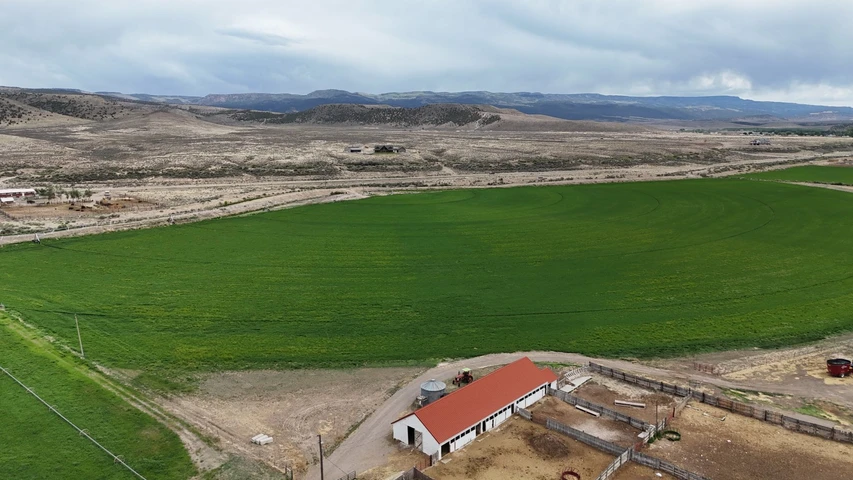
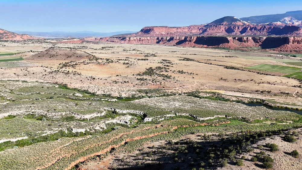
This 120-acre+ property located on the Teasdale Bench in Wayne County offers a combination of elevated terrain, expansive views, and practical improvements that support a variety of potential uses. The setting is defined by its position on a high mesa, where much of the land is relatively flat with gentle rolling contours. The landscape features a mix of open ground, sage, cactus, and scattered pinyon pine and juniper trees, covering more than 30 acres of the property.From multiple vantage points across the parcel, there are clear views of surrounding natural landmarks, including the Boulder Mountains to the south and the distinctive red rock formations and bluffs that characterize the region. The northern portion of the property drops approximately 100 feet, creating a natural edge where the Fremont River can be seen below. Along the southeastern boundary, views extend toward Cottonwood Creek, an area that supports local wildlife activity.Wildlife presence on and around the property includes mule deer, small game, coyotes, and foxes. A neighboring pond contributes to seasonal waterfowl activity, including ducks and geese, during the winter months. The combination of vegetation, water proximity, and varied terrain supports a diverse habitat.Access to the property is convenient yet maintains a sense of separation. The parcel is located just over 600 yards from the paved Teasdale Bench Road and can be reached via the Teasdale Powerline Road and other established routes. The nearby town of Torrey is only a short drive away, providing access to basic services, dining, and supplies while maintaining a rural setting.Infrastructure elements are already in place to support future use. A well permit, identified as WR 95-5525 with 1.48 acre feet of underground water rights, has been secured. Existing roads across the property provide internal access and flexibility for site planning. These features allow for multiple potential building locations depending on preference for views, access, or proximity to utilities.The property is bordered in part by public land managed by the Bureau of Land Management, which contributes to the sense of open space and limits the likelihood of nearby development. The area is also known for its low levels of light pollution, providing clear night skies and visibility of stars.This parcel presents an opportunity for those seeking a recreational property, a residential setting, or a long-term land holding in southern Utah. Its combination of acreage, location, access, and existing improvements supports a range of possibilities while maintaining the natural characteristics of the region.
Details
County: Wayne
Zipcode: 84775
Property Type One: Recreational Property
Property Type Two: Residential Property
Property Type Three: Undeveloped Land
Brokerage: Whitetail Properties Real Estate
Brokerage Link: www.whitetailproperties.com/agents/zeb-white-1

Zeb White
Whitetail Properties Real Estate
(435) 233-1175
By clicking the button, you agree to our Terms of Use and Privacy Policy.